Navigation Programme
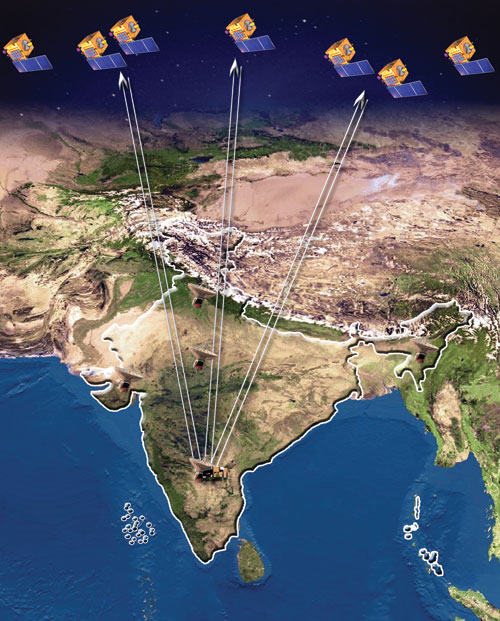
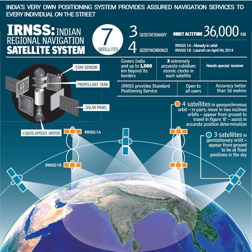
Indian Regional Navigation Satellite System (IRNSS) envisages establishment of Regional Navigational Satellite System using a combination of Geostationary and Geosynchronous spacecrafts over the Indian region. This IRNSS combination will consist of seven satellites - three in GEO orbit and four in GSO orbit. It will provide accurate real-time positioning & timing services over India and region extending to 1500 Kms around India.
These satellites will have two types of payloads, Navigation and C band Ranging payload. Navigation payload will transmit navigation service signals in L5 and S band to the users whereas the other one is used for CDMA ranging for satellite orbit determination.
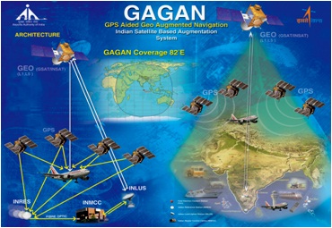
GAGAN - GPS Aided Geo Augmented Navigation is a satellite based augmentation system which will provide accurate GPS navigation system for the aviation industry. It is a joint venture between ISRO and Airport Authority of India (AAI).
The GAGAN will aim to improve the efficiency of Air Traffic Control (ATC) through this system which will give them accurate positioning of the aircraft of better than 10 meters when in flight. Currently, aircraft has to travel on a set route which may not necessarily be the shortest. The system would mean higher security, lesser travel time and eventually perhaps cheaper airfares.