

 Azadi Ka Amrit Mahotsav
 Publications List
Publications
| Image | Description | more |
|---|---|---|
_Coffee_Table_Book_2023.jpg) |
EOS-06 (oceansat-3): An Ocean of OpportunitiesThis book aims to showcase the significant achievements of the EOS-06 mission through visuals and detailed descriptions of its scientific objectives, payload specifications and applications. |
more |
 |
भारतीय विद्युत-प्रकाशीय नीतभारों का विकास: एक चित्रमयी काव्य गाथाIn this book, complex structures of payloads, their characteristics, and specific achievements related to them are presented in poetry and their beautiful sketches are hand drawn by SAC scientists. This book is an innovative and unique initiative to bring forth various interesting facts related to development of Electro-optical payloads. |
more |
 |
Desertification and Land Degradation Atlas of IndiaThe current Atlas presents State-wise Desertification and Land Degradation (DLD) Status Maps prepared using on-screen visual interpretation of Indian Remote Sensing Satellite (IRS), Advanced Wide Field Sensor (AWiFS) data of 2018-19 timeframe in GIS environment |
more |
 |
Space Based Observation of Indian WetlandsWetlands are submerged or water saturated lands, natural or man-made, inland or coastal, permanent or temporary, static or flowing, vegetated or non- vegetated, which necessarily have a land-water interface. |
more |
 |
Exploring the AntarcticThis book presents the highlights of various scientific studies in the Antarctic region undertaken by Space Applications Centre (SAC-ISRO) using the earth observation data and decade long experience (2009-2019) of participation in the expeditions to Antarctica coordinated by National Centre of Polar and Ocean Research (ESSO-NCPOR). |
more |
 |
Viewing the Oceans from Space “Think Blue: Developing the Nation’s Economy”Oceans play a key role in regulating earth's climate and also act as a carbon sink. In this booklet important ocean related applications being carried out at the Space Applications Centre pertinent to understanding of ocean processes, ocean state predictions, potential fishery zones, hazards and extremes, coastal vulnerability, etc. are portrayed. |
more |
 |
Eyes on Waves from SpaceThis atlas is based on WAVEWATCH III version 4.18 (WW3) simulations. 17 years of WW3 simulations (from 2000 to 2016) are used to generate the wave climatology, particularly over the Northern Indian Ocean region at very high spatial resolution (10x10 km). Simulations are carried out by forcing the model with ERA-Interim winds obtained from ECMWF. |
more |
 |
Coral Reef Atlas of Red Sea & Gulf of AdenA geospatial inventory of coral reef habitats of Red Sea and Gulf of Aden has been created based on Resourcesat-1 AWiFS data of 2004-2009 period. The four-level classification system for mapping Indian Ocean coral reefs have been applied to map the coral reef habitats of Red Sea and Gulf of Aden. |
more |
 |
मंगल एटलसThis scientific Mars atlas provides a glimpse of the geological features, chemical composition and atmospheric dynamics of Mars through images taken by various instruments specially Mars Colour Camera (MCC), mounted on Mars Orbiter Mission (MOM). |
more |
 |
Mars Orbiter Mission (MOM) Mars AtlasThis scientific Mars atlas provides a glimpse of the geological features, chemical composition and atmospheric dynamics of Mars through images taken by various instruments specially Mars Colour Camera (MCC), mounted on Mars Orbiter Mission (MOM). |
more |
 |
Chandrayaan-1 Lunar Science AtlasChandrayaan-1 spacecraft acquired a large volume of data of the Moon surface on various aspect of Lunar Geosciences. The present lunar science atlas is a collection of various interesting and new scientific findings in the broad field of lunar geosciences using Chandryaan-1 data. |
more |
 |
सागर के रंग उपग्रह के संगThis book contains interesting topics like genesis of ocean, its biodiversity, effect of climate change on it, and study of all these through satellite, etc. |
more |
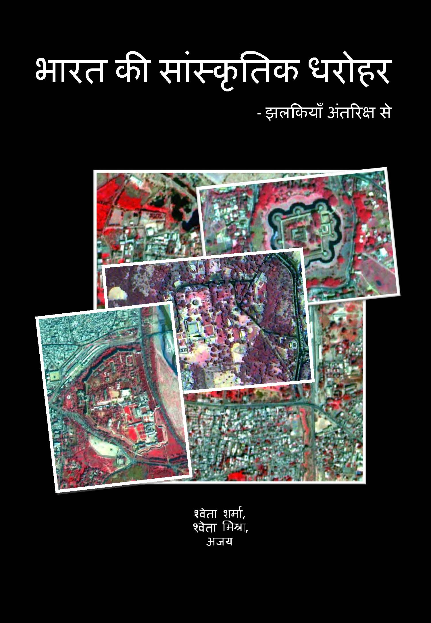 |
भारत की सांस्कृतिक धरोहर – झलकियाँ अंतरिक्ष सेCultural heritage refers to treasure of past, which are received from older generations and are to be passed on to future generations. This book covers covers cultural heritage and present general information about places through images taken by Indian Remote Sensing (IRS) satellite. |
more |
 |
Images of the Moon from Chandrayaan - 1This image collection provides the glimpses of the moon surface at very high scale basically from TMC and HySI payloads. Besides the features, this also shows some of the initial images taken by TMC of Chandrayaan-1 enroute the moon, when it imaged the earth and the moon from a distance of 70000 km and 311200 km respectively. |
more |
 2014.jpg) |
Shoreline Change Atlas of India (Volume- 5) Odisha and West BengalThis Atlas comprises of shoreline change maps prepared using satellite data of 1989-91 and 2004- 06 time frame on 1:25,000 scale for the entire country (Volume – 5 shows maps of Odisha and West Bengal). |
more |
 |
उपग्रह संचार के सिद्धांत एवं ऐन्टेना एक विहंगावलोकनIn this book, author provided brief information about fundamental principles of space; communication properties of antennas; different orbits related to satellites and their types; experiments and applications; etc. Besides it, author also discussed issues related to antenna techniques and provided excellent information regarding challenges in antenna designing. |
more |
 |
उपग्रह संचार एवं नौसंचालन अनुप्रयोग क्षेत्र एक झलकSatellite Applications and Navigation Area (SNAA) of Space Applications Centre fulfills the responsibility of developing appliances for systems for satellite communication and telecommunication (Communication) mediums, etc. |
more |
 |
Snow cover Atlas of the Tista Basin 2015-16This atlas gives sub-basin-wise distribution of snow cover in the Ganga basin from October 2015 to June 2016. The sub-basins included in this report are Alaknanda, Bhagirathi and Yamuna. |
more |
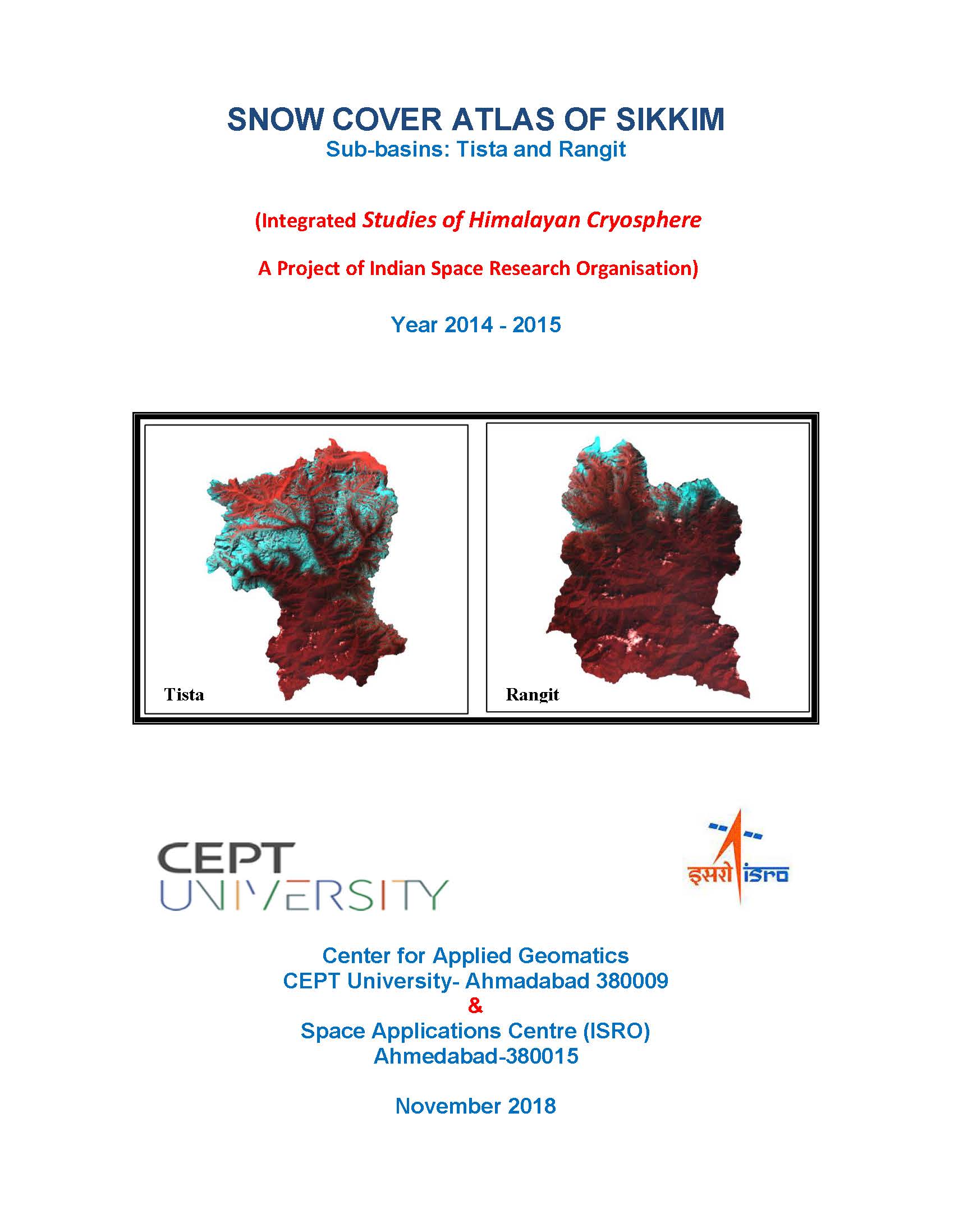 |
Snow cover Atlas of the Tista Basin 2014-15This atlas gives subbasin-wise distribution of snow cover in the Tista basin from October 2014 to June 2015. The subbasins included in this report are Tista and Rangit. |
more |
 |
Snow cover Atlas of the Tista Basin 2013-14This atlas gives subbasin-wise distribution of snow cover in the Tista basin from October 2013 to June 2014. The subbasins included in this report are Tista, and Rangit. |
more |
 |
Snow cover Atlas of the Tista Basin 2012-13This atlas gives sub-basin-wise distribution of snow cover in the Tista basin from October 2012 to June 2013. The sub-basins included in this report are Tista, and Rangit. |
more |
 |
Snow cover Atlas of the Tista Basin 2011-12This atlas gives subbasin-wise distribution of snow cover in the Tista basin from October 2011 to June 2012. The subbasins included in this report are Tista and Rangit. |
more |
 |
Snow cover Atlas of the Tista Basin 2010-11This atlas gives subbasin-wise distribution of snow cover in the Tista basin from October 2010 to June 2011. The subbasins included in this report are Tista and Rangit. |
more |
 |
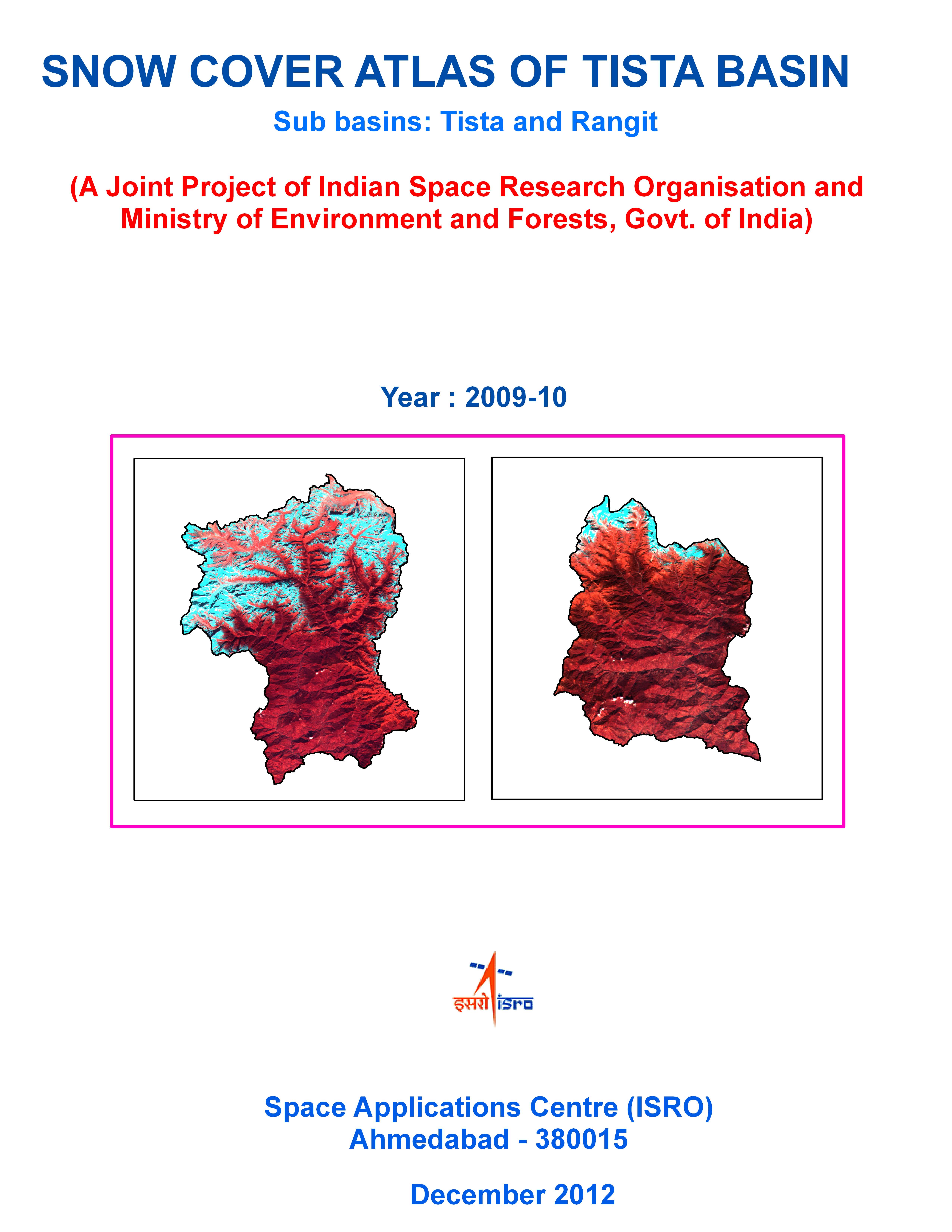
Snow cover Atlas of the Tista Basin 2009-10This atlas gives subbasin-wise distribution of snow cover in the Satluj basin from October 2009 to June 2010. The subbasins included in this report are Pin, Spiti, Baspa, Jiwa, Parbati and Beas. |
more |
 |
Snow cover Atlas of the Tista Basin 2008-09This atlas gives subbasin-wise distribution of snow cover in the Tista basin from October 2008 to June 2009. The subbasins included in this report are Tista and Rangit. |
more |
 |
सुदूर संवेदन हेतु विद्युत प्रकाशीय कैमरा- एक परिचयThrough this book, authors introduce components of an Electro-Optical Camera and describe it's application from space. Authors described complex scientific and technical principles in a very organised and apt manner and in simple language of ordinary people. |
more |
 |
Spectrum of IndiaThe airborne hyperspectral data from AVIRIS G sensor system provide unique opportunity in understanding the three-dimensional data cube, its calibration and validation. The coordinated effort by campaign and science teams facilitated the acquisitions of hyperspectral airborne data and ground-truth over 57 sites in India. The present compilation of research articles contains the initial science results using the hyperspectral data from phase-1 airborne campaign with AVlRIS -NG. |
more |
 2014.jpg) |
"Shoreline Change Atlas of India (Volume- 6) Lakshadweep Island, Andaman and Nicobar Islands"This Atlas comprises of shoreline change maps prepared using satellite data of 1989-91 and 2004- 06 time-frame on 1:25,000 scale for the entire country (Volume – 6 shows maps of Lakshadweep Islands, Andaman and Nicobar Islands). |
more |
 |
Snow cover Atlas of the Satluj Basin 2015-16This atlas gives sub-basin-wise distribution of snow cover in the Satluj basin from October 2015 to June 2016. The sub-basins included in this report are Pin, Spiti, Baspa, Jiwa, Parbati and Beas. |
more |
 |
Snow cover Atlas of the Satluj Basin 2014-15This atlas gives sub-basin-wise distribution of snow cover in the Satluj basin from October 2014 to June 2015. The sub-basins included in this report are Pin, Spiti, Baspa, Jiwa, Parbati and Beas. |
more |
 |
Snow cover Atlas of the Satluj Basin 2013-14This atlas gives subbasin-wise distribution of snow cover in the Satluj basin from October 2013 to June 2014. The subbasins included in this report are Pin, Spiti, Baspa, Jiwa, Parbati and Beas. |
more |
 |
Snow cover Atlas of the Satluj Basin 2012-13This atlas gives subbasin-wise distribution of snow cover in the Satluj basin from October 2012 to June 2013. The subbasins included in this report are Pin, Spiti, Baspa, Jiwa, Parbati and Beas. |
more |
 |
Snow cover Atlas of the Satluj Basin 2011-12This atlas gives subbasin-wise distribution of snow cover in the Satluj basin from October 2011 to June 2012. The subbasins included in this report are Pin, Spiti, Baspa, Jiwa, Parbati and Beas. |
more |
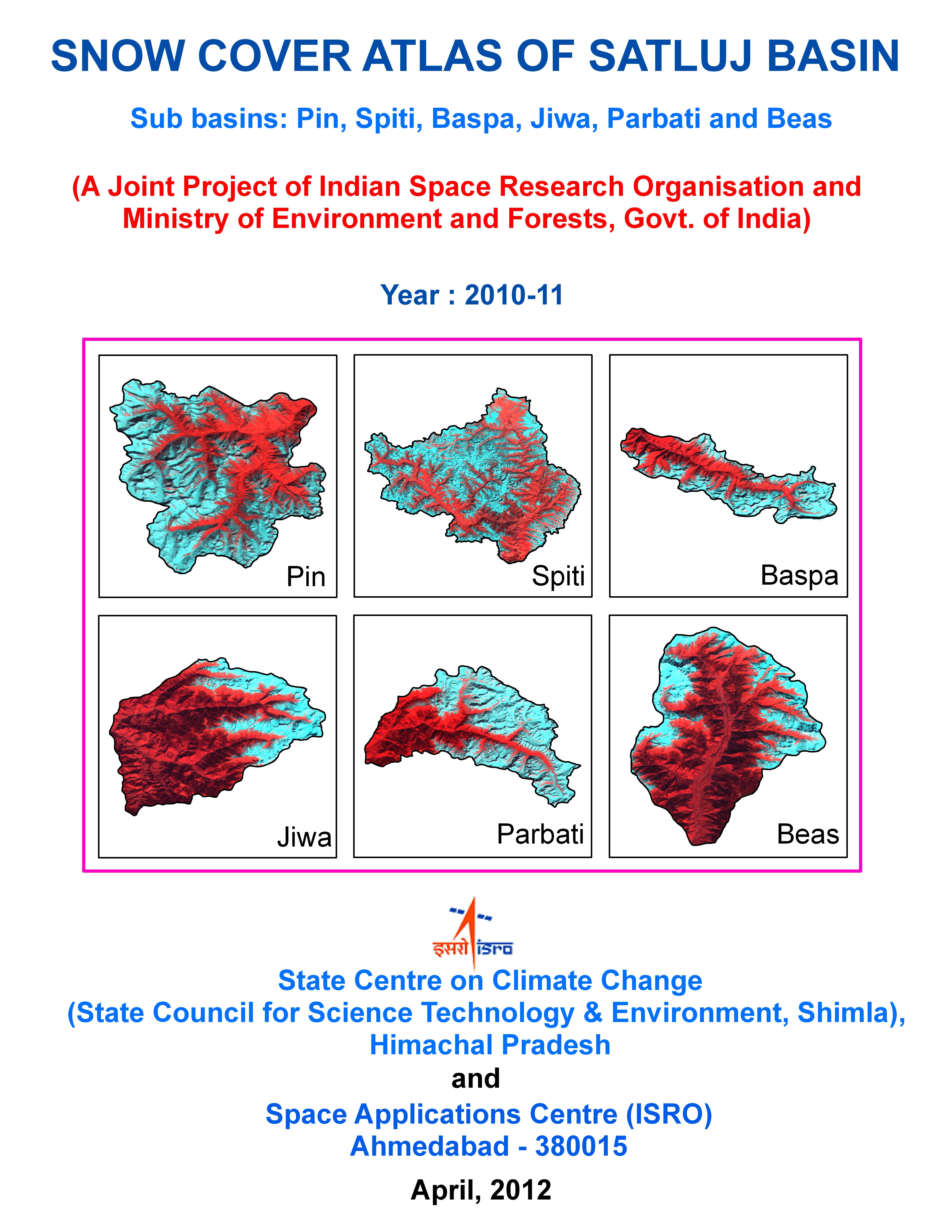 |
Snow cover Atlas of the Satluj Basin 2010-11This atlas gives subbasin-wise distribution of snow cover in the Satluj basin from October 2010 to June 2011. The subbasins included in this report are Pin, Spiti, Baspa, Jiwa, Parbati and Beas. |
more |
 |
Snow cover Atlas of the Satluj Basin 2009-10This atlas gives subbasin-wise distribution of snow over in the Satluj basin from October 2009 to June 2010. The subbasins included in this report are Pin, Spiti, Baspa, Jiwa, Parbati and Beas. |
more |
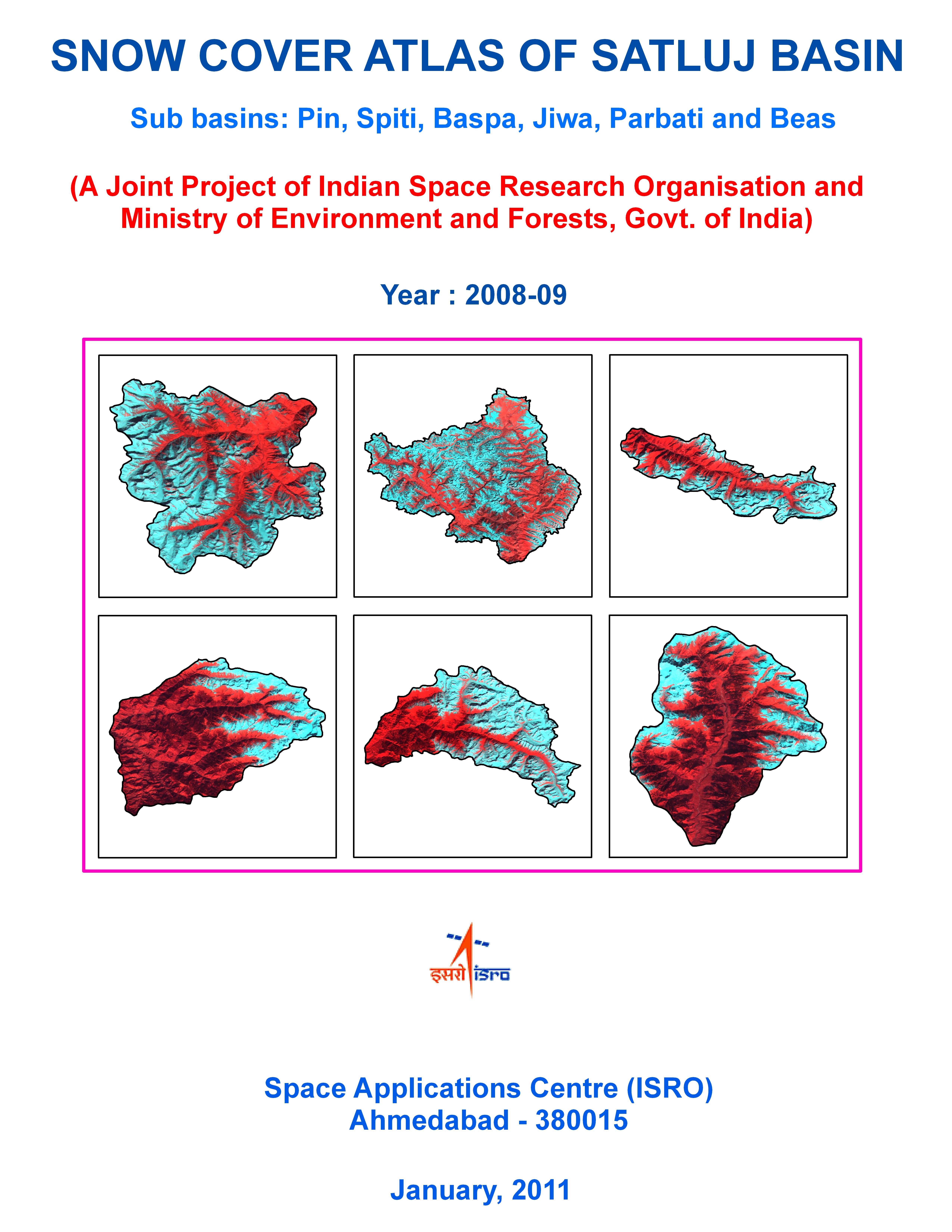 |
Snow cover Atlas of the Satluj Basin 2088-09This atlas gives subbasin-wise distribution of snow cover in the Satluj basin from October 2008 to June 2009. The subbasins included in this report are Pin, Spiti, Baspa, Jiwa, Parbati and Beas. |
more |
 2014.jpg) |
Shoreline Change Atlas of India (Volume- 2) Maharashtra and GoaThis Atlas comprises of shoreline change maps prepared using satellite data of 1989-91 and 2004-06 time-frame on 1:25,000 scales for the entire country (Volume – 2 show maps of Maharashtra and Goa). |
more |
 |
"प्रतिबिंब संकेत और डाटा प्रक्रमण में सीपा, सैक का योगदान"In this book, challenge of signal and image processing are exposed and techniques for their solution are presented. Principles and equations for processing are also presented. This book provides sufficient information and knowledge about data processing. |
more |
 |
National Wetland Inventory and Assessment- Technical Guidelines and Procedure ManualThe document provides technical guidelines for use by the participating agencies in the execution of the project on National Wetland Inventory and Assessment undertaken by Space Applications Centre, ISRO, Ahmedabad at the behest of the Ministry of Environment and Forests, Govt. of India. |
more |
 |
National Wetland Atlas: West BengalThis publication deals with the updated database and status of wetlands, compiled in Atlas format. Increasing concern about how our wetlands are being influenced has led to formulation of a project entitled National Wetland Inventory and Assessment (NWIA) to create an updated database of the wetlands of India. |
more |
 |
National Wetland Atlas: UttarakhandThis publication deals with the updated database and status of wetlands, compiled in Atlas format. Increasing concern about how our wetlands are being influenced has led to formulation of a project entitled National Wetland Inventory and Assessment (NWIA) to create an updated database of the wetlands of India. |
more |
 |
National Wetland Atlas: Uttar PradeshThis publication deals with the updated database and status of wetlands, compiled in Atlas format. Increasing concern about how our wetlands are being influenced has led to formulation of a project entitled National Wetland Inventory and Assessment (NWIA) to create an updated database of the wetlands of India. |
more |
 |
National Wetland Atlas: Union TerritoriesThis publication deals with the updated database and status of wetlands, compiled in Atlas format. Increasing concern about how our wetlands are being influenced has led to formulation of a project entitled National Wetland Inventory and Assessment (NWIA) to create an updated database of the wetlands of India. |
more |
 |
National Wetland Atlas: TripuraThis publication deals with the updated database and status of wetlands, compiled in Atlas format. Increasing concern about how our wetlands are being influenced has led to formulation of a project entitled National Wetland Inventory and Assessment (NWIA) to create an updated database of the wetlands of India. |
more |
 |
National Wetland Atlas: TamilNaduThis publication deals with the updated database and status of wetlands, compiled in Atlas format. Increasing concern about how our wetlands are being influenced has led to formulation of a project entitled National Wetland Inventory and Assessment (NWIA) to create an updated database of the wetlands of India. |
more |
 |
National Wetland Atlas: SikkimThis publication deals with the updated database and status of wetlands, compiled in Atlas format. Increasing concern about how our wetlands are being influenced has led to formulation of a project entitled National Wetland Inventory and Assessment (NWIA) to create an updated database of the wetlands of India. |
more |
 |
National Wetland Atlas: RajasthanThis publication deals with the updated database and status of wetlands, compiled in Atlas format. Increasing concern about how our wetlands are being influenced has led to formulation of a project entitled National Wetland Inventory and Assessment (NWIA) to create an updated database of the wetlands of India. |
more |
 |
National Wetland Atlas: PanjabThis publication deals with the updated database and status of wetlands, compiled in Atlas format. Increasing concern about how our wetlands are being influenced has led to formulation of a project entitled National Wetland Inventory and Assessment (NWIA) to create an updated database of the wetlands of India. |
more |
 |
National Wetland Atlas: OrissaThis publication deals with the updated database and status of wetlands, compiled in Atlas format. Increasing concern about how our wetlands are being influenced has led to formulation of a project entitled National Wetland Inventory and Assessment (NWIA) to create an updated database of the wetlands of India. |
more |
 |
National Wetland Atlas: Eastern Atlas StatesThis publication deals with the updated database and status of wetlands, compiled in Atlas format. Increasing concern about how our wetlands are being influenced has led to formulation of a project entitled National Wetland Inventory and Assessment (NWIA) to create an updated database of the wetlands of India. |
more |
 |
National Wetland Atlas: IndiaThis publication deals with the updated database and status of wetlands, compiled in Atlas format. Increasing concern about how our wetlands are being influenced has led to formulation of a project entitled National Wetland Inventory and Assessment (NWIA) to create an updated database of the wetlands of India. |
more |
 |
National Wetland Atlas: NagalandThis publication deals with the updated database and status of wetlands, compiled in Atlas format. Increasing concern about how our wetlands are being influenced has led to formulation of a project entitled National Wetland Inventory and Assessment (NWIA) to create an updated database of the wetlands of India. |
more |
 |
National Wetland Atlas: MizoramThis publication deals with the updated database and status of wetlands, compiled in Atlas format. Increasing concern about how our wetlands are being influenced has led to formulation of a project entitled National Wetland Inventory and Assessment (NWIA) to create an updated database of the wetlands of India. |
more |
 |
National Wetland Atlas: MeghalayaThis publication deals with the updated database and status of wetlands, compiled in Atlas format. Increasing concern about how our wetlands are being influenced has led to formulation of a project entitled National Wetland Inventory and Assessment (NWIA) to create an updated database of the wetlands of India. |
more |
 |
National Wetland Atlas: ManipurThis publication deals with the updated database and status of wetlands, compiled in Atlas format. Increasing concern about how our wetlands are being influenced has led to formulation of a project entitled National Wetland Inventory and Assessment (NWIA) to create an updated database of the wetlands of India. |
more |
 |
National Wetland Atlas: MaharashtraThis publication deals with the updated database and status of wetlands, compiled in Atlas format. Increasing concern about how our wetlands are being influenced has led to formulation of a project entitled National Wetland Inventory and Assessment (NWIA) to create an updated database of the wetlands of India. |
more |
 |
National Wetland Atlas: Madhya PradeshThis publication deals with the updated database and status of wetlands, compiled in Atlas format. Increasing concern about how our wetlands are being influenced has led to formulation of a project entitled National Wetland Inventory and Assessment (NWIA) to create an updated database of the wetlands of India. |
more |
 |
National Wetland Atlas: LakshadweepThis publication deals with the updated database and status of wetlands, compiled in Atlas format. Increasing concern about how our wetlands are being influenced has led to formulation of a project entitled National Wetland Inventory and Assessment (NWIA) to create an updated database of the wetlands of India. |
more |
 |
National Wetland Atlas: KeralaThis publication deals with the updated database and status of wetlands, compiled in Atlas format. Increasing concern about how our wetlands are being influenced has led to formulation of a project entitled National Wetland Inventory and Assessment (NWIA) to create an updated database of the wetlands of India. |
more |
 |
National Wetland Atlas: KarnatakaThis publication deals with the updated database and status of wetlands, compiled in Atlas format. Increasing concern about how our wetlands are being influenced has led to formulation of a project entitled National Wetland Inventory and Assessment (NWIA) to create an updated database of the wetlands of India. |
more |
 |
National Wetland Atlas: JharkhandThis publication deals with the updated database and status of wetlands, compiled in Atlas format. Increasing concern about how our wetlands are being influenced has led to formulation of a project entitled National Wetland Inventory and Assessment (NWIA) to create an updated database of the wetlands of India. |
more |
 |
National Wetland Atlas: Jammu and KashmirThis publication deals with the updated database and status of wetlands, compiled in Atlas format. Increasing concern about how our wetlands are being influenced has led to formulation of a project entitled National Wetland Inventory and Assessment (NWIA) to create an updated database of the wetlands of India. |
more |
 |
National Wetland Atlas: Himachal PradeshThis publication deals with the updated database and status of wetlands, compiled in Atlas format. Increasing concern about how our wetlands are being influenced has led to formulation of a project entitled National Wetland Inventory and Assessment (NWIA) to create an updated database of the wetlands of India. |
more |
 |
National Wetland Atlas: HaryanaThis publication deals with the updated database and status of wetlands, compiled in Atlas format. Increasing concern about how our wetlands are being influenced has led to formulation of a project entitled National Wetland Inventory and Assessment (NWIA) to create an updated database of the wetlands of India. |
more |
 |
National Wetland Atlas: GujaratThis publication deals with the updated database and status of wetlands, compiled in Atlas format. Increasing concern about how our wetlands are being influenced has led to formulation of a project entitled National Wetland Inventory and Assessment (NWIA) to create an updated database of the wetlands of India. |
more |
 |
National Wetland Atlas: GoaThis publication deals with the updated database and status of wetlands, compiled in Atlas format. Increasing concern about how our wetlands are being influenced has led to formulation of a project entitled National Wetland Inventory and Assessment (NWIA) to create an updated database of the wetlands of India. |
more |
 |
National Wetland Atlas: DelhiThis publication deals with the updated database and status of wetlands, compiled in Atlas format. Increasing concern about how our wetlands are being influenced has led to formulation of a project entitled National Wetland Inventory and Assessment (NWIA) to create an updated database of the wetlands of India. |
more |
 |
National Wetland Atlas: ChhattisgarhThis publication deals with the updated database and status of wetlands, compiled in Atlas format. Increasing concern about how our wetlands are being influenced has led to formulation of a project entitled National Wetland Inventory and Assessment (NWIA) to create an updated database of the wetlands of India. |
more |
 |
National Wetland Atlas: AssamThis publication deals with the updated database and status of wetlands, compiled in Atlas format. Increasing concern about how our wetlands are being influenced has led to formulation of a project entitled National Wetland Inventory and Assessment (NWIA) to create an updated database of the wetlands of India. |
more |
 |
National Wetland Atlas: Arunachal PradeshThis publication deals with the updated database and status of wetlands, compiled in Atlas format. Increasing concern about how our wetlands are being influenced has led to formulation of a project entitled National Wetland Inventory and Assessment (NWIA) to create an updated database of the wetlands of India. |
more |
 |
National Wetland Atlas: Andhra PradeshThis publication deals with the updated database and status of wetlands, compiled in Atlas format. Increasing concern about how our wetlands are being influenced has led to formulation of a project entitled National Wetland Inventory and Assessment (NWIA) to create an updated database of the wetlands of India. |
more |
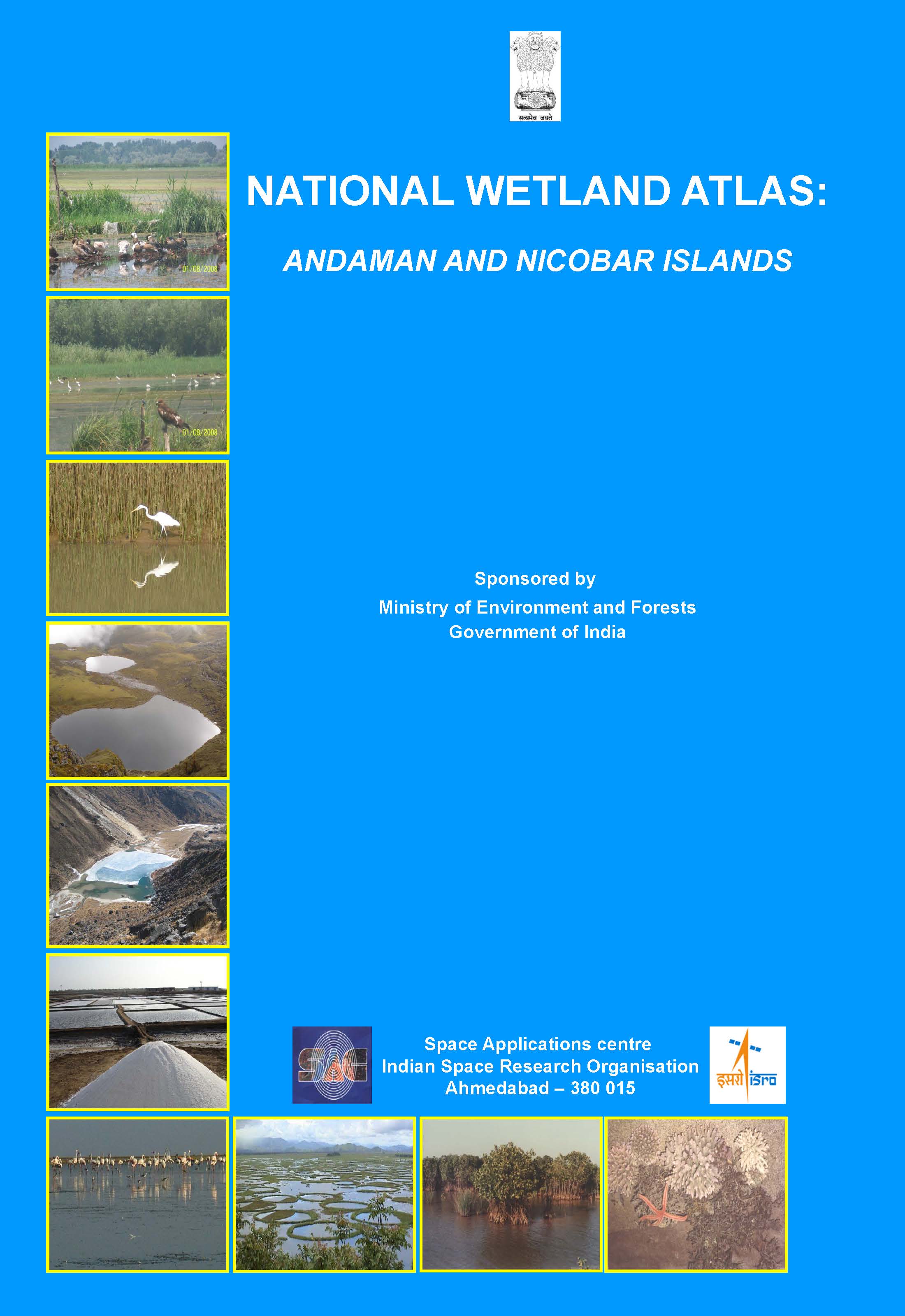 |
National Wetland Atlas: Andaman and Nicobar IslandsThis publication deals with the updated database and status of wetlands, compiled in Atlas format. Increasing concern about how our wetlands are being influenced has led to formulation of a project entitled National Wetland Inventory and Assessment (NWIA) to create an updated database of the wetlands of India. |
more |
 |
National Wetland Atlas: Wetlands of International Importance under Ramsar ConventionThis publication deals with the updated database and status of wetlands, compiled in Atlas format. Increasing concern about how our wetlands are being influenced has led to formulation of a project entitled National Wetland Inventory and Assessment (NWIA) to create a database of the wetlands of India. |
more |
 |
National Wetland Atlas: High Altitude Lakes of IndiaThe 'High Altitude Lakes- HAL' found at an altitude above 3000 m, above mean sea level (amsl), mainly in the Himalayan region, is one of the important natural wetlands of India. |
more |
 |
Monitoring Snow and Glaciers of Himalayan RegionThis document provides details of the salient findings of a national project entitled, ?Monitoring Snow and Glaciers of Himalayan region (Phase-II)?, taken up under National Natural Resources Management (NNRMS) Program and jointly sponsored by the Ministry of Environment, Forest and Climate Change (MoEF&CC) and Department of Space (DOS). |
more |
 2014.jpg) |
Shoreline Change Atlas of India (Volume- 3) Karnataka and KeralaThis Atlas comprises of shoreline change maps prepared using satellite data of 1989-91 and 2004- 06 time-frame on 1:25,000 scale for the entire country (Volume – 3 shows maps of Karnataka and Kerala). |
more |
 2021.jpg) |
Shoreline Change Atlas of India (Volume- 3) Karnataka and KeralaThis Atlas comprises of shoreline change maps prepared using satellite data of 2004-06 and 2014-16 time-frames on 1:25,000 scale for the entire country (Volume – III shows maps of Karnataka and Kerala). |
more |
 |
कृत्रिम उपग्रहों में ऊष्मीय प्रबंधनIn this book, alongwith basic information about structure of satellites, importance of thermal management in satellites is highlighted. It is tried to present main topics of thermal management in satellites, like - heat transfer, orbital thermal loads and thermal analysis in simple words. |
more |
 |
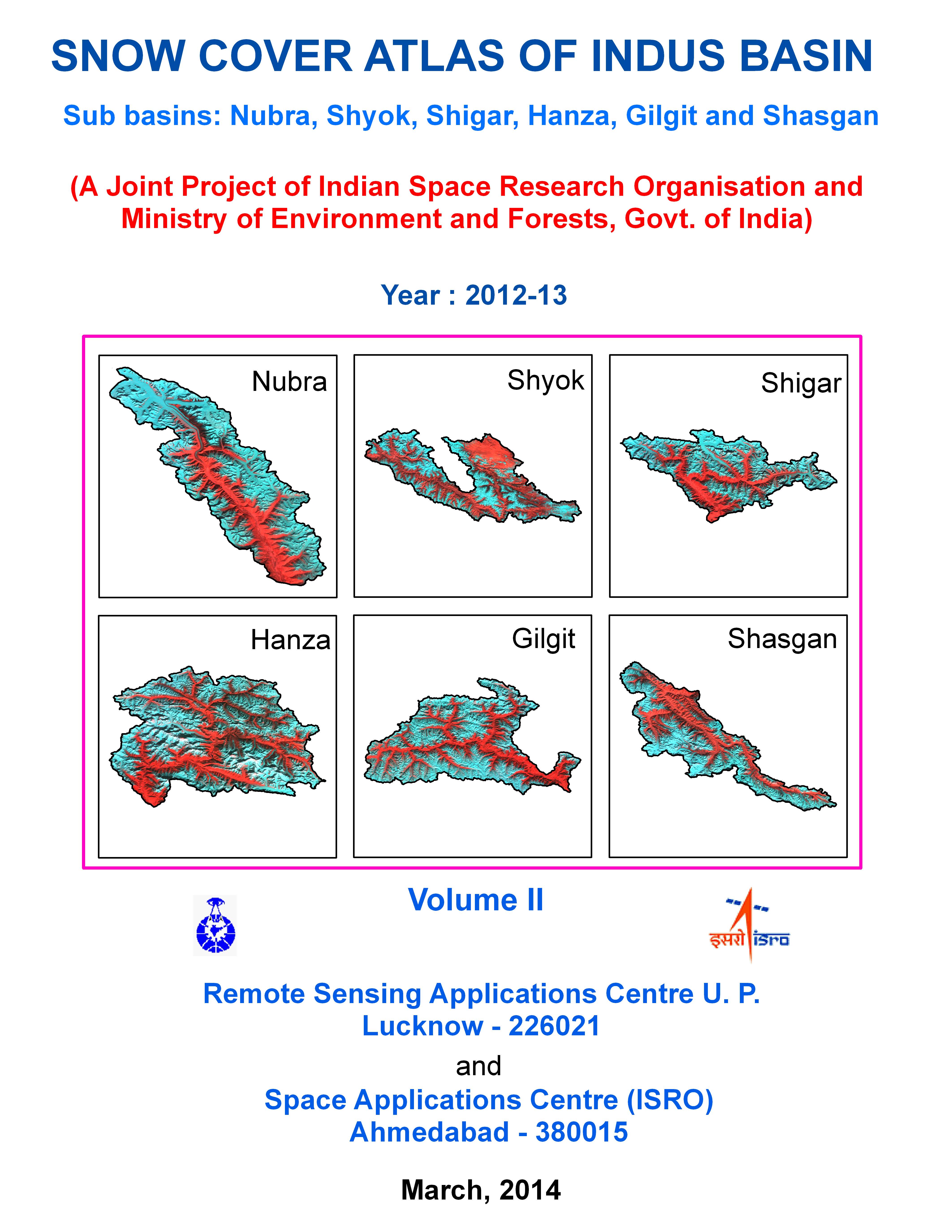
Snow cover Atlas of the Indus Basin 2015-16: Volume-llThis atlas gives subbasin-wise distribution of snow cover in the Indus basin from October 2015 to June 2016. The subbasins included in this report are Nubra, Shyok, Shigar, Hanza, Gilgit and Shasgan. |
more |
 |
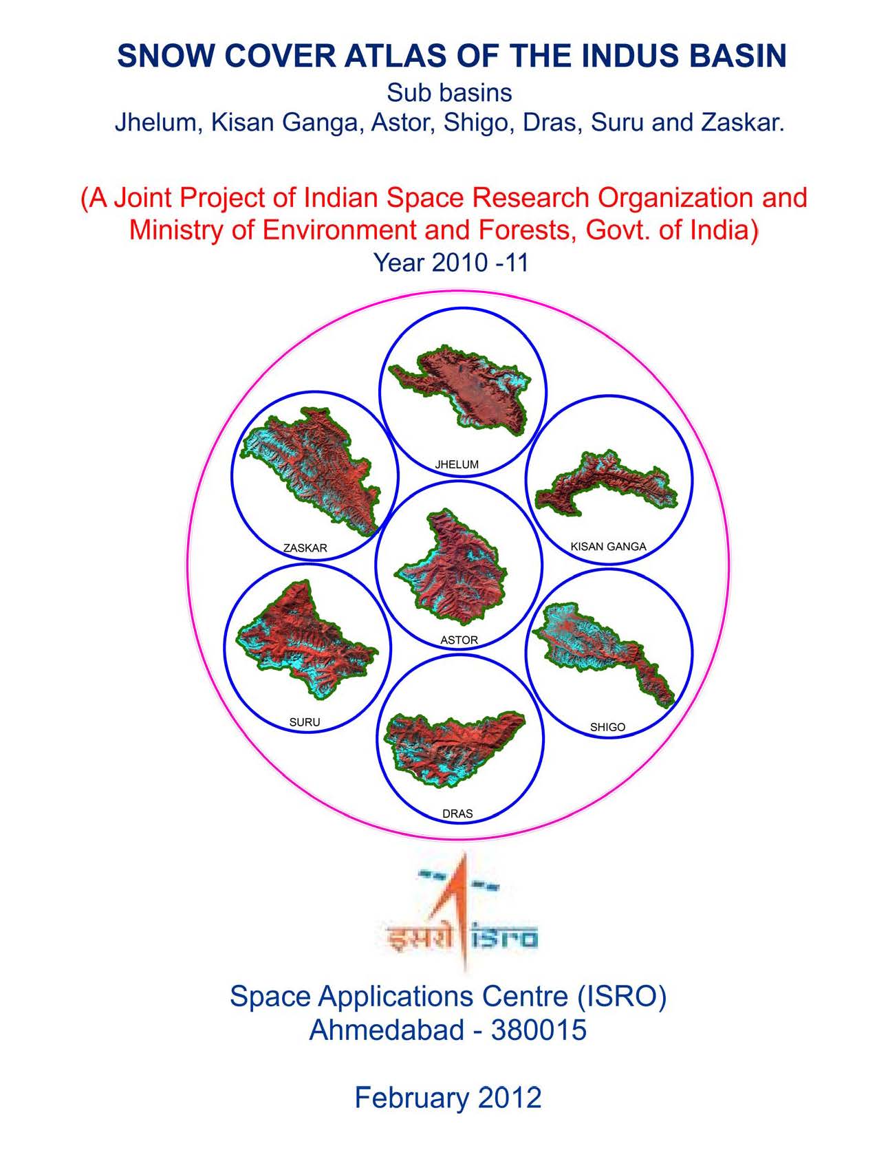
Snow cover Atlas of the Indus Basin2015-16: Volume-lThis atlas gives subbasin-wise distribution of snow cover in the Indus basin from October 2015 to June 2016. The subbasins included in this report are Jhelum, Kisan ganga, Astor, Shigo, Dras, Suru and Zaskar. |
more |
 |
Snow cover Atlas of the Indus Basin 2014-15: Volume-lThis atlas gives subbasin-wise distribution of snow cover in the Indus basin from October 2014 to June 2015. The subbasins included in this report are Jhelum, Kisan ganga, Astor, Shigo, Dras, Suru and Zaskar. |
more |
 |
Snow cover Atlas of the Indus Basin 2013-14: Volume-llThis atlas gives subbasin-wise distribution of snow cover in the Indus basin from October 2013 to June 2014. The subbasins included in this report are Nubra, Shyok, Shigar, Hanza, Gilgit and Shasgan. |
more |
 |
Snow cover Atlas of the Indus Basin 2013-14: Volume-lThis atlas gives subbasin-wise distribution of snow cover in the Indus basin from October 2013 to June 2014. The subbasins included in this report are Jhelum, Kisan ganga, Astor, Shigo, Dras, Suru and Zaskar. |
more |
 |
Snow cover Atlas of the Indus Basin 2012-13: Volume-llThis atlas gives subbasin-wise distribution of snow cover in the Indus basin from October 2012 to June 2013. The subbasins included in this report are Nubra, Shyok, Shigar, Hanza, Gilgit and Shasgan. |
more |
 |
Snow cover Atlas of the Indus Basin 2012-13: Volume-lThis atlas gives subbasin-wise distribution of snow cover in the Indus basin from October 2012 to June 2013. The subbasins included in this report are Jhelum, Kisan ganga, Astor, Shigo, Dras, Suru and Zaskar. |
more |
 |
Snow cover Atlas of the Indus Basin 2011-12: Volume-llThis atlas gives subbasin-wise distribution of snow cover in the Indus basin from October 2011 to June 2012. The subbasins included in this report are Nubra, Shyok, Shigar, Hanza, Gilgit and Shasgan. |
more |
 |
Snow cover Atlas of the Indus Basin 2011-12: Volume-lThis atlas gives subbasin-wise distribution of snow cover in the Indus basin from October 2011 to June 2012. The subbasins included in this report are Jhelum, Kisan ganga, Astor, Shigo, Dras, Suru and Zaskar. |
more |
 |
Snow cover Atlas of the Indus Basin 2010-11: Volume-llThis atlas gives subbasin-wise distribution of snow cover in the Indus basin from October 2010 to June 2011. The subbasins included in this report are Nubra, Shyok, Shigar, Hanza, Gilgit and Shasgan. |
more |
 |
Snow cover Atlas of the Indus Basin 2010-11: Volume-lThis atlas gives subbasin-wise distribution of snow cover in the Indus basin from October 2010 to June 2011. The subbasins included in this report are Jhelum, Kisan ganga, Astor, Shigo, Dras, Suru and Zaskar. |
more |
 |
Snow cover Atlas of the Indus Basin 2009-10: Volume-llThis atlas gives subbasin-wise distribution of snow cover in the Indus basin from October 2009 to June 2010. The subbasins included in this report are Nubra, Shyok, Shigar, Hanza, Gilgit and Shasgan. |
more |
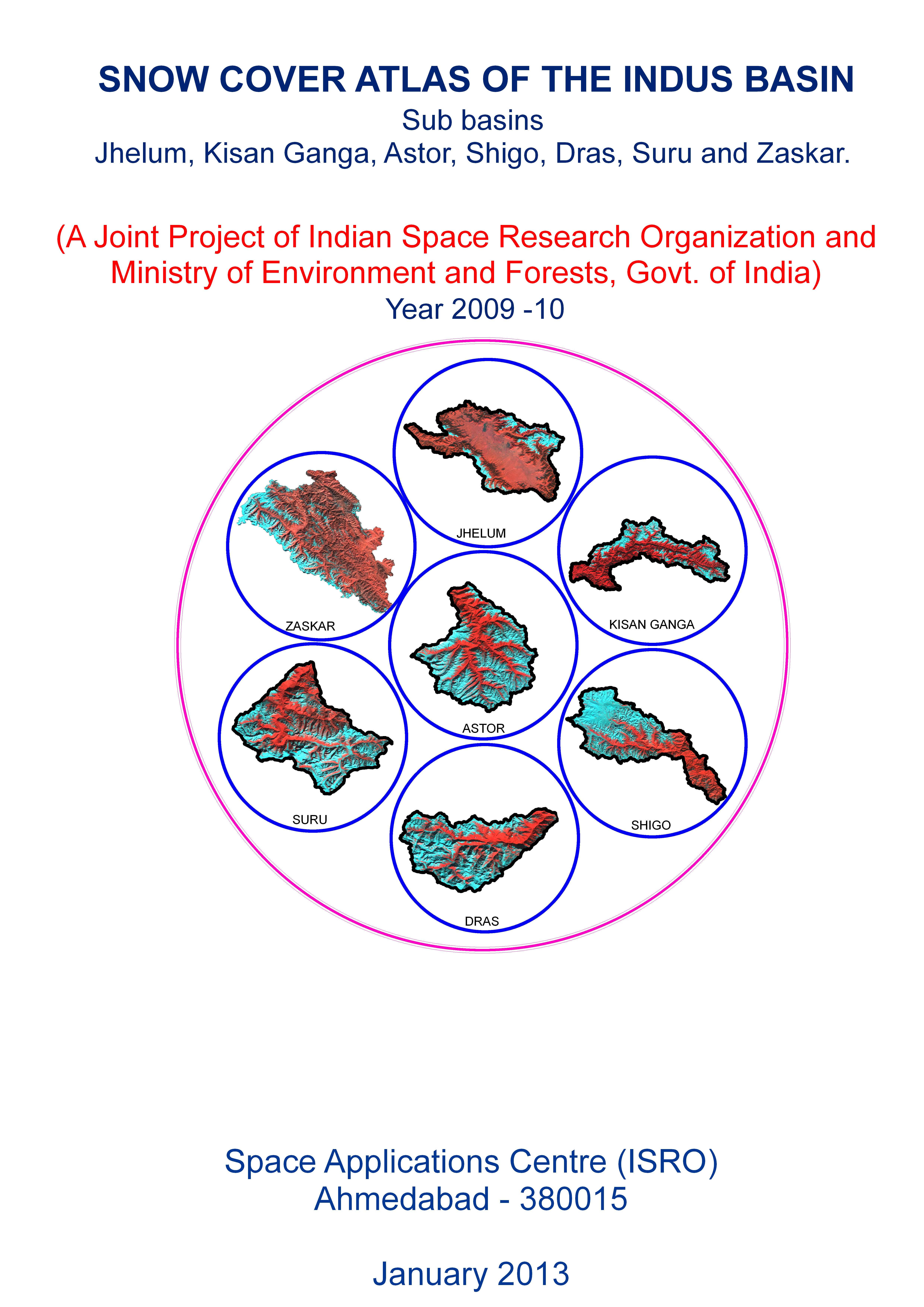 |
Snow cover Atlas of the Indus Basin 2009-10: Volume-lThis atlas gives subbasin-wise distribution of snow cover in the Indus basin from October 2009 to June 2010. The subbasins included in this report are Jhelum, Kisan ganga, Astor, Shigo, Dras, Suru and Zaskar. |
more |
 |
Snow cover Atlas of the Indus Basin 2008-09This atlas gives subbasin-wise distribution of snow cover in the Indus basin from October 2008 to June 2009. The subbasins included in this report are Jhelum, Kisan ganga, Astor, Shigo, Dras, Suru and Zaskar. |
more |
 2014.jpg) |
"Shoreline Change Atlas of India (Volume- 1) Gujarat, Daman and Diu"This Atlas comprises of shoreline change maps prepared using satellite data of 1989-91 and 2004-06 time-frame on 1:25,000 scales for the entire country (Volume – 1 show maps of Gujarat, Daman and Diu). The maps show eroding, stable and accreting coast. Data used, methodology, results, area under erosion and accretion and status of coastal protection measures are briefly described. |
more |
 |
Snow cover Atlas of the Ganga Basin 2015-16This atlas gives sub-basin-wise distribution of snow cover in the Ganga basin from October 2015 to June 2016. The sub-basins included in this report are Alaknanda, Bhagirathi and Yamuna. |
more |
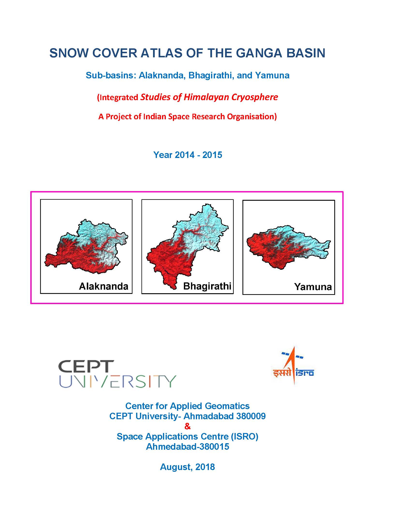 |
Snow cover Atlas of the Ganga Basin 2014-15This atlas gives sub-basin-wise distribution of snow cover in the Ganga basin from October 2014 to June 2015. The sub-basins included in this report are Alaknanda, Bhagirathi and Yamuna. |
more |
 |
Snow cover Atlas of the Ganga Basin2013-14This atlas gives subbasin-wise distribution of snow cover in the Ganga basin from October 2013 to June 2014. The subbasins included in this report are Alaknanda, Bhagirathi and Yamuna. |
more |
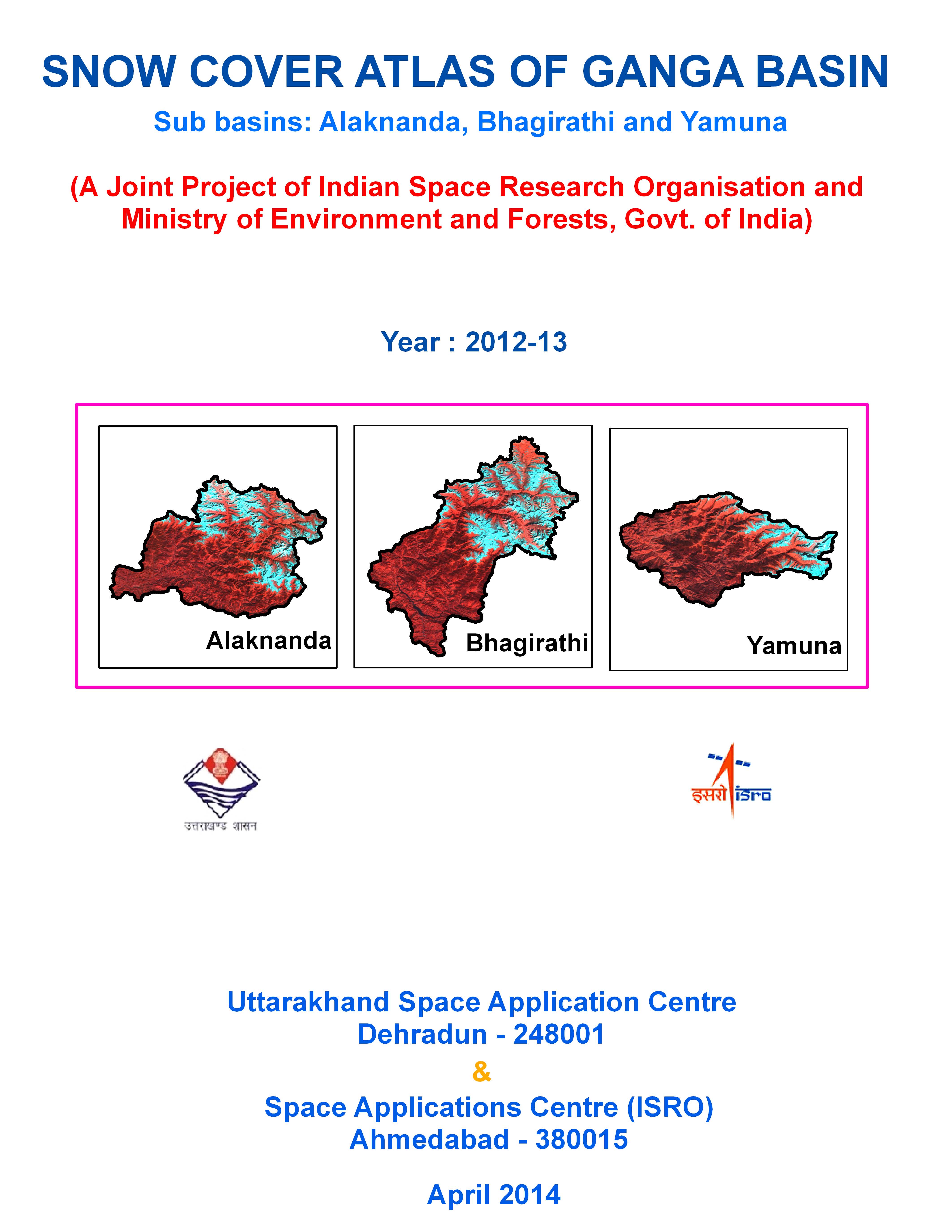 |
Snow cover Atlas of the Ganga Basin 2012-13This atlas gives subbasin-wise distribution of snow cover in the Ganga basin from October 2012 to June 2013. The subbasins included in this report are Alaknanda, Bhagirathi and Yamuna. |
more |
 |
Snow cover Atlas of the Ganga Basin 2011-12This atlas gives subbasin-wise distribution of snow cover in the Ganga basin from October 2011 to June 2012. The subbasins included in this report are Alaknanda, Bhagirathi and Yamuna. |
more |
 |
Snow cover Atlas of the Ganga Basin 2010-11This atlas gives subbasin-wise distribution of snow cover in the Ganga basin from October 2010 to June 2011. The subbasins included in this report are Alaknanda, Bhagirathi and Yamuna. |
more |
 |
Snow cover Atlas of the Ganga Basin 2009-10This atlas gives subbasin-wise distribution of snow cover in the Ganga basin from October 2009 to June 2010. The subbasins included in this report are Alaknanda, Bhagirathi and Yamuna. |
more |
 |
Snow cover Atlas of the Ganga Basin 2008-09This atlas gives subbasin-wise distribution of snow cover in the Ganga basin from October 2008 to June 2009. The subbasins included in this report are Alaknanda, Bhagirathi and Yamuna. |
more |
 2021.jpg) |
"Shoreline Change Atlas of India (Volume- 4) Andhra Pradesh, Tamil Nadu, Pondicherry"This Atlas comprises of shoreline change maps prepared using satellite data of 2004-06 and 2014-16 time-frames on 1:25,000 scale for the entire country (Volume – IV shows maps of Tamil Nadu, Puducherry and Andhra Pradesh). |
more |
 2021.jpg) |
Shoreline Change Atlas of India (Volume- 5) Odisha and West BengalThis Atlas comprises of shoreline change maps prepared using satellite data of 2004-06 and 2014-16 time-frames on 1:25,000 scale for the entire country (Volume – V shows maps of Odisha and West Bengal). |
more |
 |
Desertification Status Mapping of India 2nd Cycle: Technical GuidelinesThis document briefs on the desertification indicators, comprehensive classification system, methodology and legend for Desertification Status Mapping of drylands evolved and standardized for the country during cycle 1 of the project, in cold and hot regions of the country. |
more |
 |
Desertification Land Degradation Atlas of Selected Districts of India: Volume-2This Atlas presents Desertification /Land Degradation Status Maps depicting Land Use, Process of Degradation and Severity Level along with area statistics consolidated for entire country as well state-wise for 2011-13 and 2003-05 time frame and reports the changes. Volume-2 of the atlas includes districts of Maharashtra to West Bengal. |
more |
 |
Desertification Land Degradation Atlas of Selected Districts of India: Volume-1This Atlas presents Desertification /Land Degradation Status Maps depicting Land Use, Process of Degradation and Severity Level along with area statistics consolidated for entire country as well state-wise for 2011-13 and 2003-05 time frame and reports the changes. Volume-1 of the atlas includes districts of Andhra Pradesh to Madhya Pradesh. |
more |
 2021.jpg) |
"Shoreline Change Atlas of India (Volume- 6) Lakshadweep Island, Andaman and Nicobar Islands"This Atlas comprises of shoreline change maps prepared using satellite data of 2004-06 and 2014-16 time-frames on 1:25,000 scale for the entire country (Volume – VI Lakshadweep, Andaman and Nicobar Islands). |
more |
 |
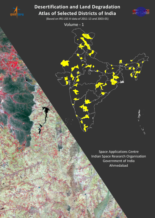
Desertification and Land Degradation Atlas of IndiaThis Atlas presents Desertification /Land Degradation Status Maps depicting Land Use, Process of Degradation and Severity Level along with area statistics consolidated for entire country as well state-wise for 2011-13 and 2003-05 time frame and reports the changes. |
more |
 2014.jpg) |
"Shoreline Change Atlas of India (Volume- 4) Andhra Pradesh, Tamil Nadu, Pondicherry"This Atlas comprises of shoreline change maps prepared using satellite data of 1989-91 and 2004- 06 time-frame on 1:25,000 scale for the entire country (Volume – 4 shows maps of Andhra Pradesh, Tamil Nadu and Puducherry). |
more |
 |
Snow cover Atlas of the Chenab Basin 2015-16This atlas gives sub-basin wise distribution of snow cover in the Chenab basin from October 2015 to June 2016. The sub-basins included in this report are Ravi, Chandra, Bhaga, Miyar, Bhut and Warwan. |
more |
 |
Snow cover Atlas of the Chenab Basin 2014-15This atlas gives sub-basin wise distribution of snow cover in the Chenab basin from October 2014 to June 2015. The sub-basins included in this report are Ravi, Chandra, Bhaga, Miyar, Bhut and Warwan. |
more |
 |
Snow cover Atlas of the Chenab Basin 2013-14This atlas gives subbasin-wise distribution of snow cover in the Chenab basin from October 2013 to June 2014. The subbasins included in this report are Ravi, Chandra, Bhaga, Miyar, Bhut and Warwan. |
more |
 |
Snow cover Atlas of the Chenab Basin 2012-13This atlas gives subbasin-wise distribution of snow cover in the Chenab basin from October 2012 to June 2013. The subbasins included in this report are Ravi, Chandra, Bhaga, Miyar, Bhut and Warwan. |
more |
 |
Snow cover Atlas of the Chenab Basin 2011-12This atlas gives subbasin-wise distribution of snow cover in the Chenab basin from October 2011 to June 2012. The subbasins included in this report are Ravi, Chandra, Bhaga, Miyar, Bhut and Warwan. |
more |
 |
Snow cover Atlas of the Chenab Basin 2010-11This atlas gives subbasin-wise distribution of snow cover in the Chenab basin from October 2010 to June 2011. The subbasins included in this report are Ravi, Chandra, Bhaga, Miyar, Bhut and Warwan. |
more |
 |
Snow cover Atlas of the Chenab Basin 2009-10This atlas gives subbasin-wise distribution of snow cover in the Chenab basin from October 2009 to June 2010. The subbasins included in this report are Ravi, Chandra, Bhaga, Miyar, Bhut and Warwan. |
more |
 2021.jpg) |
Shoreline Change Atlas of India (Volume- 2) Maharashtra and GoaThis Atlas comprises of shoreline change maps prepared using satellite data of 2004-06 and 2014-16 time-frames on 1:25,000 scale for the entire country (Volume – II shows maps of Maharashtra and Goa). |
more |
 |
Snow cover Atlas of Brahmaputra Basin 2015-16This atlas gives sub basin-wise distribution of snow cover in the Brahmaputra basin from October 2015 to June 2016. The sub basins included in this report are Dibang, Subansiri and Tawang. |
more |
 |
Snow cover Atlas of Brahmaputra Basin 2013-14This atlas gives sub basin-wise distribution of snow cover in the Brahmaputra basin from October 2013 to June 2014. The sub basins included in this report are Dibang, Subansiri and Tawang. |
more |
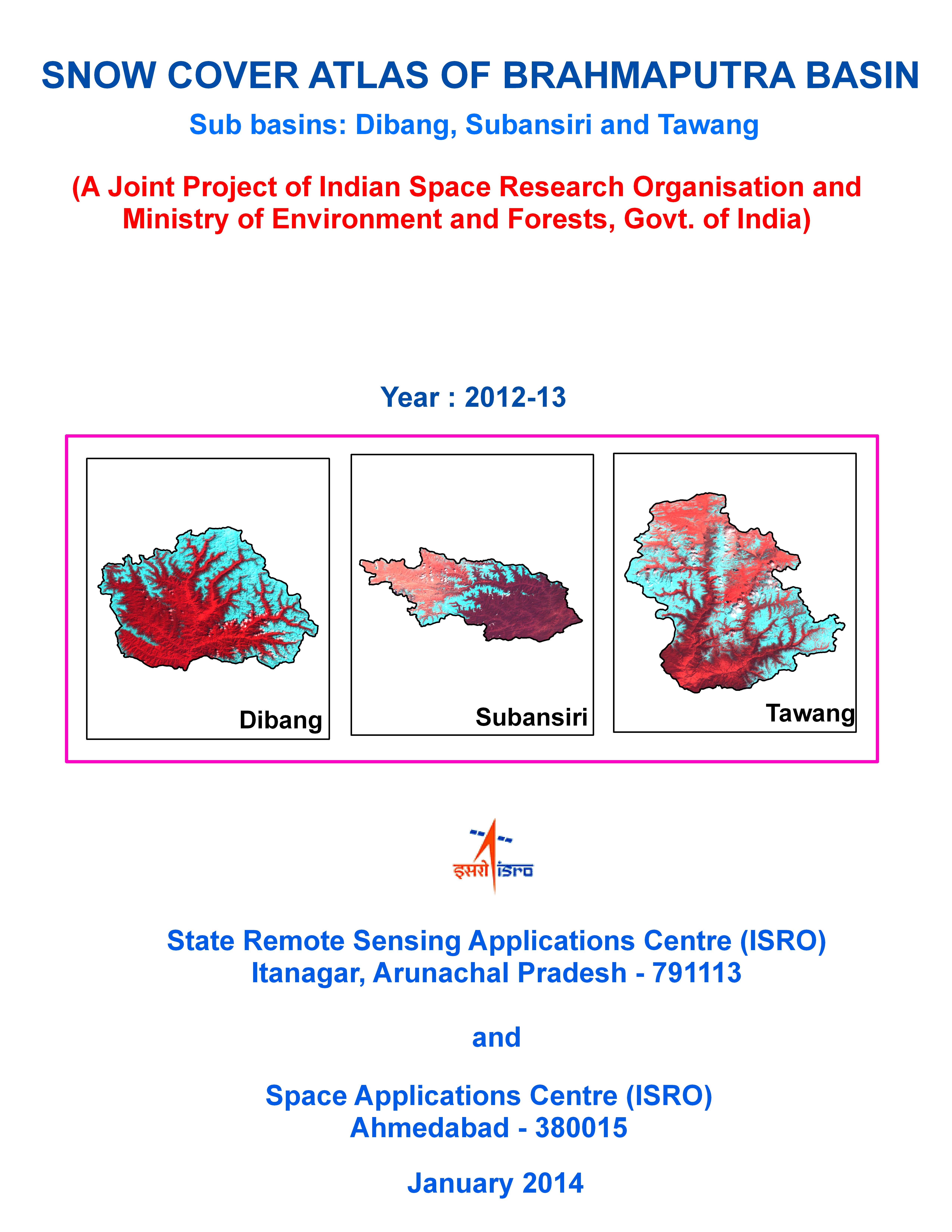 |
Snow cover Atlas of Brahmaputra Basin 2012-13This atlas gives sub basin-wise distribution of snow cover in the Brahmaputra basin from October 2012 to June 2013. The sub basins included in this report are Dibhang, Subansiri and Tawang. |
more |
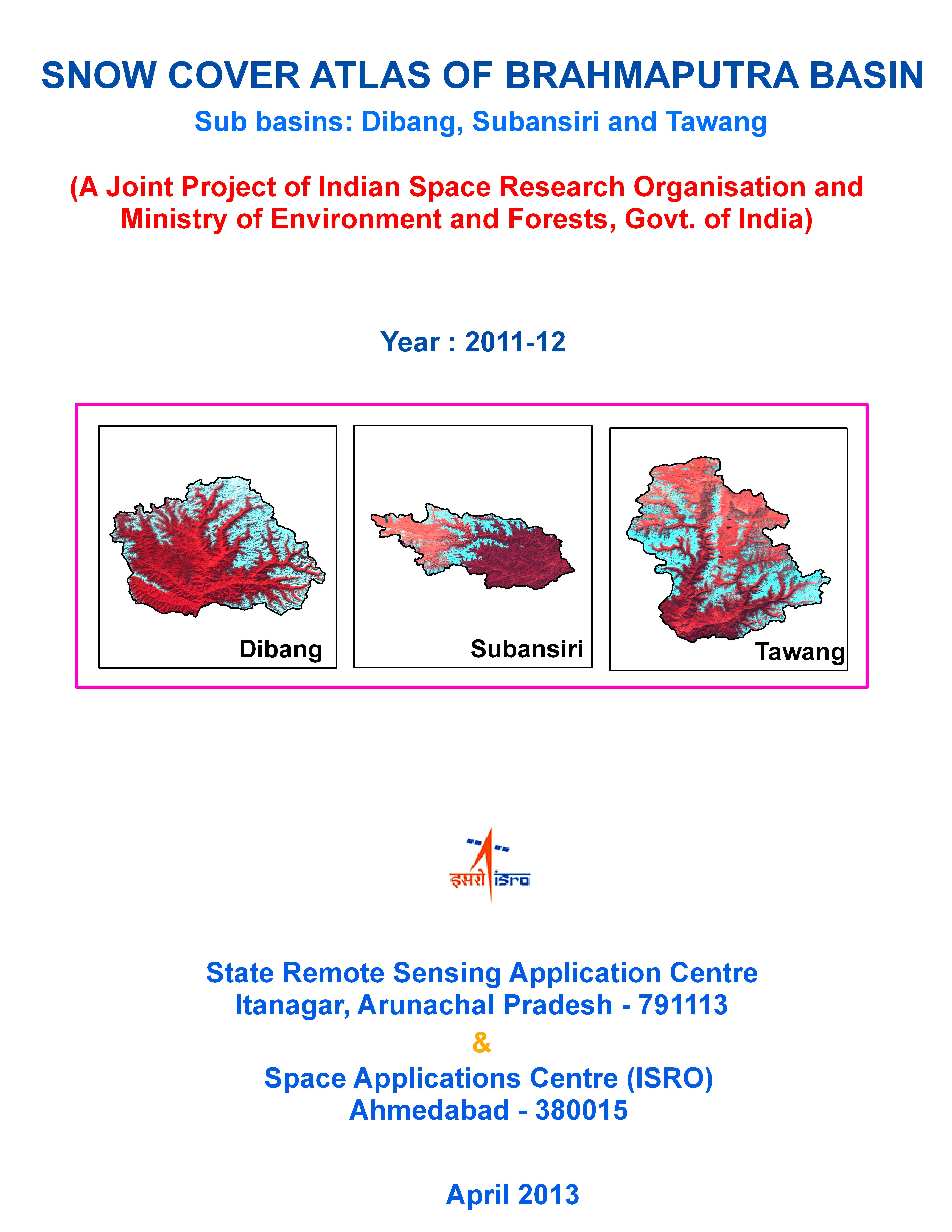 |
Snow cover Atlas of Brahmaputra Basin 2011-12This atlas gives sub basin-wise distribution of snow cover in the Brahmaputra basin from October 2011 to June 2012. The sub basins included in this report are Dibhang, Subansiri and Tawang. |
more |
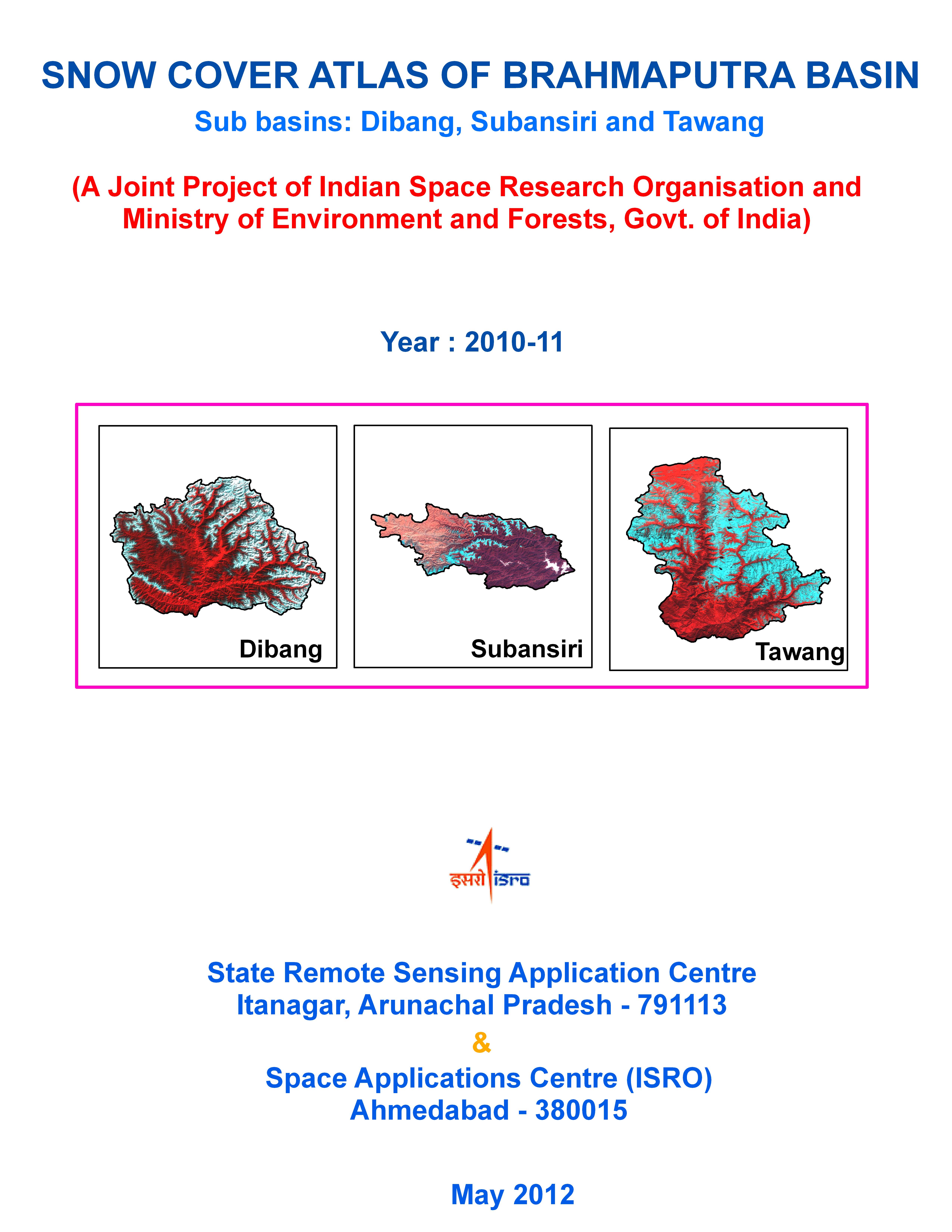 |
Snow cover Atlas of Brahmaputra Basin 2010-11This atlas gives sub basin-wise distribution of snow cover in the Brahmaputra basin from October 2010 to June 2011. The sub basins included in this report are Dibhang, Subansiri and Tawang. |
more |
 |
Snow cover Atlas of Brahmaputra Basin 2009-10This atlas gives sub basin-wise distribution of snow cover in the Brahmaputra basin from October 2009 to June 2010. The sub basins included in this report are Dibhang, Subansiri and Tawang. |
more |
 |
Snow cover Atlas of Brahmaputra Basin 2008-09This atlas gives sub basin-wise distribution of snow cover in the Brahmaputra basin from October 2008 to June 2009. The sub basins included in this report are Dibhang, Subansiri and Tawang. This data will be useful for hydrological and climatological applications. |
more |
 2021.jpg) |
"Shoreline Change Atlas of India (Volume- 1) Gujarat, Daman and Diu"This Atlas comprises of shoreline change maps prepared using satellite data of 2004-06 and 2014-16 time-frames on 1:25,000 scale for the entire country (Volume – I shows maps of Gujarat, Daman and Diu). |
more |
 |
अंतरिक्ष की दुनिया में वार्तालापThrough catoons, this book depicts conversations between structures that goes to space. Feelings and sufferings of space systems are presented in very simple words through cartoons. This book contains information about various missions, satellites, rockets, payloads, etc. of Indian Space Research Organization (ISRO). |
more |
.jpg) |
An Atlas of the Arctic and the Antarctic Sea Ice Trends (1999-2009)- Derived from Quikscat Scatterometer DataThis report summarizes the recent changes that have taken place in the sea ice extent over the hemispheric level as well as at 1x1 degree grid cell level using QuikSCAT Ku-band scatterometer data (1999-2009). |
more |
 |
A Glimpse of India by RISAT-1: Part-1The first volume titled “A Glimpse of India by RISAT-1: Part-1” , brings out the glimpses of utilisation potential of RISAT-1 with respect to various applications. The images are taken from RISAT-1 India Mosaic , Antarctic Mosaic and from individual scenes. |
more |
- About us
- Projects and Activities
- Work with SAC
- Business with SAC
- Resources
- Public Relations
- Students Corner
- Staff Corner

All Rights Reserved with Space Applications Centre.
This site belongs to Space Applications Centre, Indian Space Research Organisation, Department of Space, Government of India
Material featured on this site may be reproduced free of charge in any format or media without requiring specific permission except where specifically stated otherwise. This is subject to the material being reproduced accurately and not being used in a derogatory manner or in misleading context. Where the material is being published or issued to others, the source must be prominently acknowledged. However, the deemed permission to reproduce this material does not extend to any material on this site, which is explicitly identified as being copyright of a third party as well as to materials contained in the hyper linked sites. Authorization to reproduce such material must be obtained from the copyright holders concerned
Best Viewed with 1600x900 resolution or above | Supports Browsers IE 9.0 / Firefox 30.0 / Chrome 30.0 onwards