Oceans occupy almost 3/4th of the surface of our planet. They have profound impact on climate and weather. SAC has a dedicated team of scientists and researchers for physical oceanography. The current research includes retrieval of various oceanic parameters from satellite observations, ocean process studies utilizing satellite imagery, observing simulation sensitivity experiment (OSSE) using satellite data and numerical modelling, value added product generation based on space-borne observations.
1. Retrieval of oceanic winds and Significant Wave Height
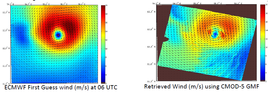
- Retrieval of oceanic winds using scatterometer data and Synthetic Aperture Radar (SAR) data is a critical aspect of modern oceanographic and atmospheric studies.
- Ocean surface winds play a pivotal role in driving ocean circulation, exchanging heat and momentum between the atmosphere and the ocean, and influencing weather patterns. Accurate retrieval of these winds is essential for understanding and predicting phenomena such as tropical cyclones, monsoons, and coastal upwelling.
- Scatterometers and SAR provide complementary high-resolution measurements of ocean surface wind vectors. Scatterometers, with their wide-swath coverage, deliver consistent global wind fields, while SAR offers unparalleled spatial detail, especially useful in coastal regions and extreme weather conditions.
- Significant Wave Height (SWH) is another critical parameter that describes the energy and dynamics of ocean waves. Retrieval of SWH from GNSS-R is an innovative approach to monitor the ocean surface.
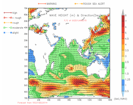 Wave
Wave
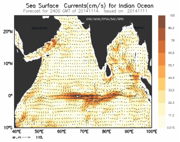 Circulation
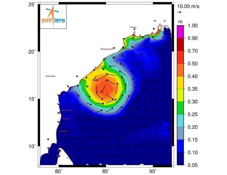 Storm Surge
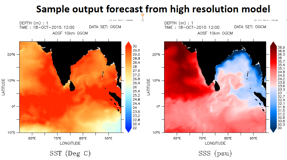 High resolution Sea surface temperature and Salinity from MOM-3 model
2. Ocean Process Studies utilizing satellite imagery Oceanic Eddy:
- The oceanic eddy parameter information was prepared for 24 years (1993 - 2016) over Bay of Bengal using AVISO. Merged and gridded satellite altimeter product of sea surface height (SSH) anomaly at 7-day interval having special resolution of 0.25o has been used for present study. Mesoscale oceanic eddies have been identified and tracked in weekly merged altimeter product of Sea Surface Height (SSH) from AVISO. Eddies have been identified based on closed contour approach followed by shape criteria. An automated tracking algorithm has been employed to track these eddies with different lifetime. The trajectories of eddies have been computed from their time history. Present method has been used separately for cold core and warm core eddies.
- Ocean Process study via finite size Lyapunov exponents fields:
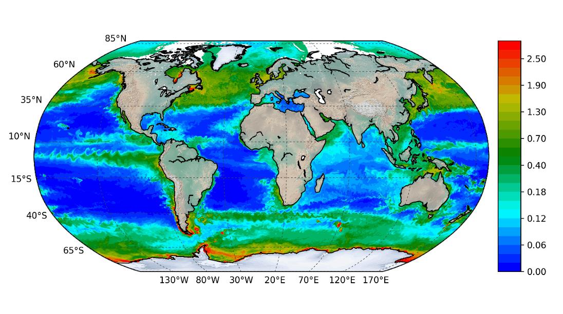
- The role of dispersion processes is investigated using FSLE in the distribution of tracer fields. In this study, winds from scatterometer, and currents from altimeter are used. The Chlorophyll from OCM-3 is used as tracer fields.
- Internal Solitary Waves:
- Characteristics of internal solitary waves (ISW) such as wavelength, propagation direction are studied using SAR imagery. The dynamical parameters associated with ISW such as the phase propagation speed and amplitude are also computed for both Andaman Sea and Arabian Sea regions.
- Sub-mesoscale features in SWOT:
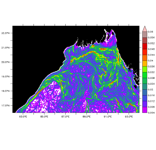 High resolution 2D SSHA fields from SWOT reveal sub-mesoscale ocean features such as fronts and eddies which were previously difficult to observe from conventional altimeters.
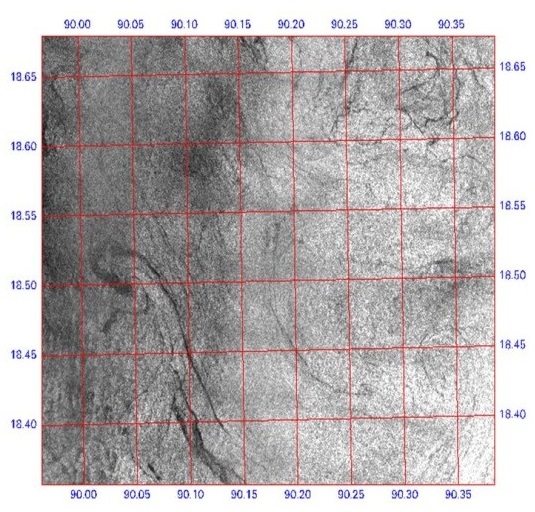 Internal waves characteristics:
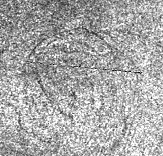 ISW-induced changes in sea surface height (SSH) are not detectable through SAR or optical sensors, necessitating the use of radar altimetry for accurate SSH measurements. The recently launched SWOT satellite provides unprecedented two-dimensional sea level observations with an accuracy of ~3cm, enabling the detection of ISW. The ISW wavelength, wave propagation direction, phase speed, amplitude and associated energy are computed using SWOT observations.
3. Value added products Reconstruction of High Resolution Sea Surface Salinity (HRSSS):
- Reconstruction of High Resolution Sea Surface Salinity (HRSSS) using low resolution satellite observations with Lagrangian technique in Bay of Bengal (2022-till date) is carried out. The HRSSS is generated at 10km spatial resolution.
- Potential Fishing Zone (PFZ):
- Upgraded the PFZ detection algorithm with possibility (low, medium or high), persistence (0 or 1) and propagation (angle) of fish catch. In this work, the Persistent information of PFZ locations is provided even in the absence of chlorophyll data using the information from relative wind fields and thermal fronts. The possible propagation, persistence of the identified location and Possibility of the catch is also added
- 4. Advanced R & D
 Detection Marine Debris:
 Two indexes are computed from Sentinel-2 observations for detecting floating materials - the Floating Debris Index (FDI) and normalized difference vegetation index (NDVI). The difference between FDI and NDVI gives the information of floating materials except weeds and algae. Spectral un-mixing helps to classify the floating materials and label the plastic pixels
 Oil-spill trajectory monitoring:


 )
)