SAC is involved in applications of remote sensing and GIS technology in geosciences and executes several projects for societal benefits. Some of the major thrust research areas are related to coastal and marine geosciences, geodynamics, geo-hazards, mineral, hydrocarbon and geo-archaeological exploration. SAC conceptualizes and carries out R&D as well operational utilization of the Indian Satellites in various application areas of geosciences. It interacts with several related Central and State Government Departments, Ministries and academic institutes of the country as well international agencies for defining its priorities, developing techniques as partner institutes and transfer of technology. Key ongoing projects are:
- Desertification Status Mapping of India
- Shoreline Change Mapping of the Indian Coast
- Modelling Coastal Sediment Transport and its Impact on Coastal Environment
- Modelling Marine Lithospheric using satellite derived geoid and gravity data
- Integrated Coastal Zone Management
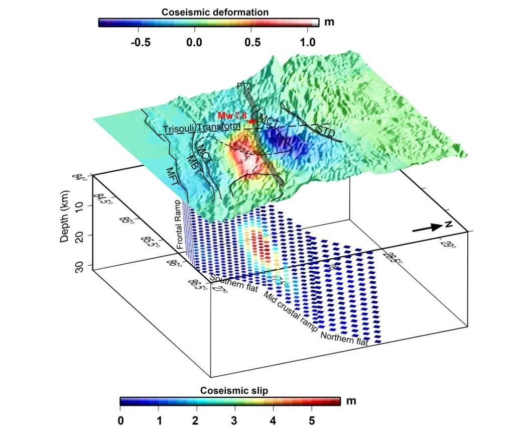
- Earthquake Precursors
- Coastal Vulnerability due to storm surges and tsunami
- Geodynamic studies
- Hyperspectral Studies